
Gold Run Creek
[Brief] A Gold Run next to a Silvertip.
Published 9-12-2020 | Last updated 9-12-2020
60.720, -149.316
[Unofficial name, no GNIS Entry]
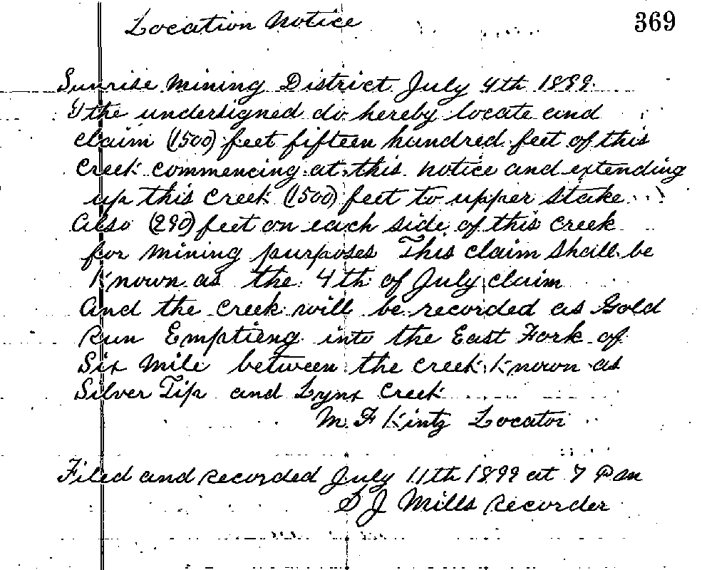
A nondescript creek flows into the East Fork Sixmile Creek on the opposite bank from the Granite Creek Campground, near the Johnson Pass Trailhead at Mile 64 of the Seward Highway. It is very unlikely that any proposal to officially name this creek has ever been submitted to the Board of Geographic Names. It has never been labeled on any well-known map, and was not even drawn on the 1959 Seward quadrangle map. But on July 4th, 1899, gold prospector M.F. Kintz pinned his hopes and a name on it: Gold Run Creek.[1]
If you’re aware of any other local names for this creek, please contact the Choss Lore project.
Click the thumbnails to explore a gallery:


Sources
[1] Mills, S.J. Location Notice, Sunrise Mining District Mining Book 33, 369.